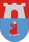
Szerencs
 |
Szerencs grew into a town where the Great Plain and the Zemplén mountains meet. It is the cultural and economic centre of Southern Hegyalja. This small town, with rich historical past, is called the Gate of Hegyalja and due to it was inhabited in ancient times.
The first authentic written record about the one-thousand-year-old Szerencs dates back to a document from the 13th century. In 1241 the monastery of crusaders from St. John-order (the Joannists) stood here, which was named “Szerencs-Abbey of the Apostles called St. Peter and St. Paul”. The documents from the end of the 15th century refer to the settlement as a town.
The most important part of the history of the town can be connected to the era of Zsigmond Rákóczi, around the 16th and 17th centuries.
In 1605 in Szerencs on his land the parliament was convoked where István Bocskai was elected the Governor of Transylvania.
Programme “Day of Szerencs town“ has been organized since 1998 to celebrate this historical event on 20 April, every year.
István Bocskai gave Szerencs the status of a royal town with significant privileges in 1606.
Among the Rákóczi Family the last lord of the Szerencs-castle was Ferenc Rákóczi II. In the 18th century, in the era of Mária Terézia, the settlement began to show slow economic development. Then this development came to a sudden stop and during the administrative reform of 1876 Szerencs was qualified as a large village, i.e. it lost its status as a medieval market town.
Establishing industries at the end of the 19th century gave a new pace to the settlement.
The greatest sugar factory and refinery at that time of Europe were built here during 8 months in 1889. The chocolate factory was built in 1923, and its products made the name of Szerencs known nationally. Between the two world wars the settlement developed, but not at an earlier rapid pace. Szerencs had a population of 6707 residents in 1930. The factories, the rolling mill and the quarry provided a decent living for the people living here.
Map - Szerencs
Map


Country - Hungary
 |
 |
| Flag of Hungary | |
The territory of present-day Hungary has for centuries been a crossroads for various peoples, including Celts, Romans, Germanic tribes, Huns, West Slavs and the Avars. The foundation of the Hungarian state was established in the late 9th century AD with the conquest of the Carpathian Basin by Hungarian grand prince Árpád. His great-grandson Stephen I ascended the throne in 1000, converting his realm to a Christian kingdom. By the 12th century, Hungary became a regional power, reaching its cultural and political height in the 15th century. Following the Battle of Mohács in 1526, it was partially occupied by the Ottoman Empire (1541–1699). Hungary came under Habsburg rule at the turn of the 18th century, later joining with the Austrian Empire to form Austria-Hungary, a major power into the early 20th century.
Currency / Language
| ISO | Currency | Symbol | Significant figures |
|---|---|---|---|
| HUF | Hungarian forint | Ft | 2 |
| ISO | Language |
|---|---|
| HU | Hungarian language |